Locations
One region, a full range of looks.
A photographic tour of Snoqualmie Valley filming categories. The full searchable library lives on Reel-Scout — contact the committee for specific requests or scouting support.
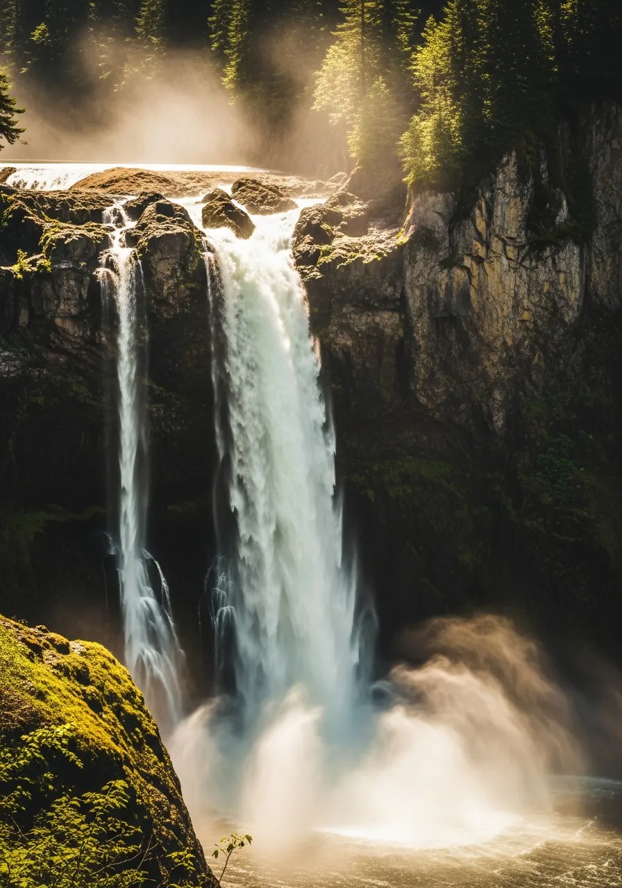
Thundering water, year-round.
Waterfalls & Rivers
Snoqualmie Falls is one of the most photographed waterfalls in the Pacific Northwest — a 268-foot drop with multiple overlooks and approaches. The Middle Fork and main Snoqualmie rivers wind through working farmland and forested gorges, giving productions a wide range of moving-water looks within minutes of each other.
- Snoqualmie Falls (upper and lower overlooks)
- Middle Fork Snoqualmie River
- Tolt River confluence
- Salish Lodge exterior
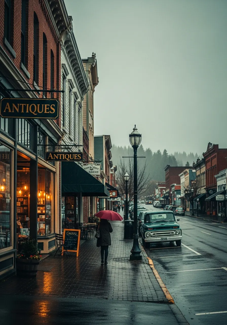
Century-old storefronts, still working.
Historic Downtowns
Snoqualmie and North Bend retain walkable early-1900s main streets — wood-frame storefronts, brick facades, classic diners, and a preserved rail depot. These downtowns have doubled for small-town USA across decades of film and television, most famously in Twin Peaks.
- Downtown North Bend (Bendigo Boulevard)
- Downtown Snoqualmie (Railroad Avenue)
- Twede's Cafe (Double R Diner)
- Carnation main street
- Northwest Railway Museum depot
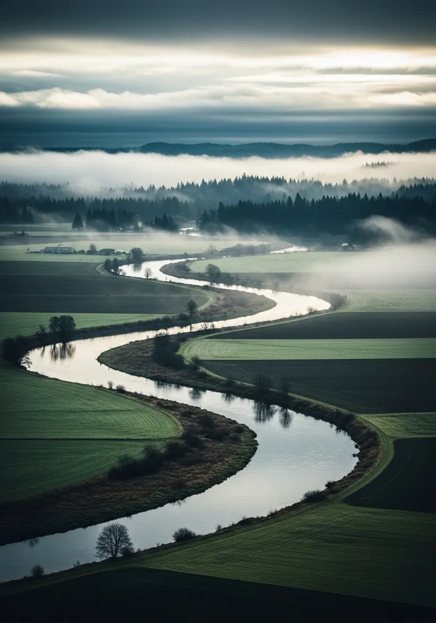
Timeless, working, uncluttered.
Farmland & Open Space
Pastures, dairy farms, barns, and open meadows flank the Snoqualmie River along the Valley floor. Power lines are sparse; mountains frame nearly every angle. Reinig Road's sycamore tree tunnel is the single most recognizable farmland shot in the Valley — Twin Peaks viewers know it as the closing credits road.
- Reinig Road tree tunnel
- Snoqualmie Valley dairies and pastures
- Tolt-MacDonald Park
- Meadowbrook Farm
- Carnation Farms
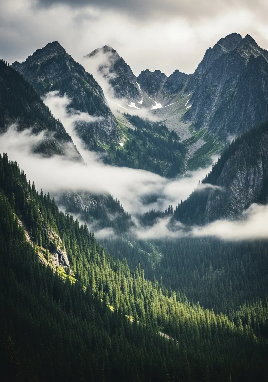
Mountain backdrops, 20 minutes up the trail.
Cascade Vistas
Rattlesnake Ledge, Mount Si, and the upper Valley give productions dramatic Cascade backdrops with relatively quick trail access. Lake visibility, snow cover, and alpenglow all shift dramatically by season — worth scouting in the specific month you plan to shoot.
- Rattlesnake Ledge + Lake
- Mount Si (trailhead and lower viewpoints)
- Cedar Butte
- Little Si
- Upper Valley panoramas
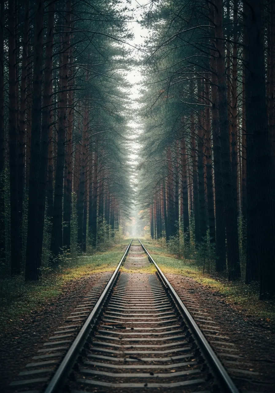
An active heritage railway and miles of corridor.
Rail Heritage
The Northwest Railway Museum maintains a working heritage railway out of the Snoqualmie Depot — historic locomotives, rolling stock, a fully restored depot, and miles of rail corridor through forest and farmland. Period rail shots and modern rolling stock both work here.
- Snoqualmie Depot (1890)
- Northwest Railway Museum rolling stock
- Active heritage rail corridor
- Historic freight house
- Train Shed Exhibit Hall
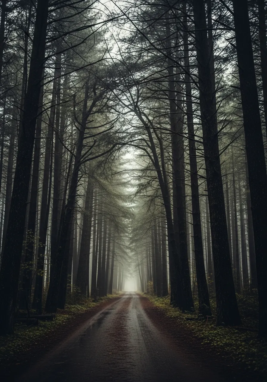
Closed-canopy Pacific Northwest.
Forest Roads & Logging Country
Service roads, logging roads, and trailheads thread the forested foothills east of the Valley. Moss-draped trees, mist, and tight canopies give productions unmistakable deep-PNW texture — the look Train Dreams (2024) used for its early-20th-century forestry scenes.
- Middle Fork Road corridor
- Twin Falls approach
- Rattlesnake Mountain service roads
- Tiger Mountain forest trails
- Snoqualmie Tree Farm roads (with permission)
A scouting gallery to set the mood.
A quick visual tour of the categories above. Each image links to its section — use it as shorthand when pitching the Valley internally.
Getting here
Distance from SEA-TAC
SEA-TAC to Snoqualmie or North Bend is roughly 32–35 miles, usually 45–50 minutes by car in normal traffic. Snoqualmie Falls is 33–35 miles from the airport. Snoqualmie Pass is farther — about 57–59 miles, roughly 1 hour to 1 hour 5 minutes by car.
Need something specific?
Scouting for a location with particular requirements — a specific era of architecture, a quiet stretch of river, a working farm that welcomes productions? The committee knows the Valley intimately and can save you scouting days. Reach out and we’ll point you in the right direction.
Committee line: 425.888.6362